Saturday, November 24, 2018

Standing stones of Termon

Now, I don't know if this is a coincidence or a sign from the Universe or the circular reality of the Oneness of All Being. You be the judge. 

Just the other evening, our friend suggested we watch Children of the Stone, a children's mini-series broadcast in the UK in 1977. We watched the entire thing on youtube. 

IMDB reviews include:


Children Of The Stones has been called 'the children's Wicker Man' - one indication of the high regard with which this seven-part 1977 British television series is still held. Resemblances between Robin Hardy's 1973 cult classic are certainly strong, notably the pervasive strength of the pagan cult which threatens to overwhelm Adam Brake (Gareth Thomas) and his son Matthew (Peter Denim).

Wonderful HTV series for children that still sends a shiver up the spine, Children of the Stones is a masterclass in how to create atmosphere on a low budget, although the plot, largely borrowed from Invasion of the Body Snatchers, doesn't make a great deal of sense.

The music was so corny I almost abandoned the video immediately. It was extremely bad and amateurish. It almost makes the film unwatchable, like something in a high school video project.


Click there and advance to the 23:00 mark. 

I've never had visions when touching a standing stone. Yet. 

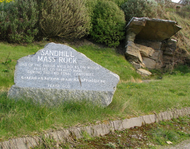
Today we visited two standing stones near Termon.


That lovely photo lives on this Irish Megaliths page.  There's more info about The Barnes Lower Standing Stones on Megalithic Ireland.

The sun wasn't shining, and it was nearly raining when we visited. It was more like this:


I like to pay attention to what the stone is looking at: 


Then this happened. 


Friday, November 23, 2018

The Rental Market Around Here

We like the house we're renting, but we keep an eye out for other rentals in case something better and cheaper becomes available. 

We saw this house for rent €150 less than we're paying now. 


Well, that's a nice cottage. 

Artemis checked out the map and it's in a great neighborhood, not too far from our village, and near Ards forest were we like to walk. 

Then she checked out the "street view" of the map. Instead of the outside of the house, street view shows the interior. I know that's a new feature, but....


You have to admit those green stones beside the hearth are gorgeous.


Entryway and window treatments would take getting used to. 

Thursday, November 22, 2018

Thoughts in a Graveyard


Today is Thanksgiving in the States, but Thursday in Ireland. Black Friday is a thing here, but nobody likes it. 


 A friend is visiting and we walked up the hill behind the village to the old church and its two graveyards. 

There are two Protestant churches in Dunfanaghy, plus this ruin. There is one Catholic church, across the road from the work house. 


Pippin contemplated his mortality while standing on a 400 year old grave slab, but I didn't. I simply felt my gratitude for this life, in this place, this afternoon. 


Tuesday, November 20, 2018

Thanksgiving Comes Early to Dunfanaghy


On the way home from Dublin yesterday I heard a commercial on the radio for "Black Friday Week Sale."


So much wrong there. Without Thanksgiving to constrain it, what's to stop Black Friday Week from disordering the whole month of November?


How I remember Leftovers Day: rainy walks on the beach, cuddling with friends watching a stack VCR movies, a third pumpkin pie slice. I pitied people who insisted on putting on shoes and going to the mall. What a waste. The best day off of the year.


Last Saturday night, we hosted a crowd of friends to a Thanksgiving feast. (It would be too hard for folks to come to dinner on a random Thursday afternoon.) Most of our Irish friends had never attended one and were excited to sample those dishes showcased in every US holiday movie.


Artemis cooked a traditional menu, beginning with a 28 pound turkey our village butcher found for us over in Lifford. Irish people eat turkeys only at Christmas, so we had to get a special order. She named him Liam, and he just fit into the oven.


Artemis made stuffing, roasted sweet potatoes half-covered with marshmallow, green bean casserole, cranberry sauce, brussel sprouts, turkey and mushroom gravies, dinner rolls, and a mountain of mashed spuds. Everyone seemed to love everything, and the table fell silent a few times in that way of people digging in.


Outside of those quiet moments of mastication, we praised the chef, learned that cranberry sauce isn't jelly, and speculated on the pies we were leaving room for. Artemis had buy cans of pumpkin online because it's not eaten here. Imagine a world without pumpkin spice lattes: that's Ireland. She also had to send away for pie tins. "American pie" is not eaten here: a wide shallow pan with a sloping side. Tart pans with straight sides are everywhere.


I was asked about the roots of Thanksgiving, so I said it was first instituted by Abraham Lincoln as a national holiday during the Civil War. I explained that it commemorates that time when Native people helped the pilgrims from England in the 17th Century; most of our guests knew that story and identified with the Native Americans.


It was a perfect Thanksgiving, without shopping or football or family drama. All we needed were our friends back home. We love living in Ireland, but we miss our friends most deeply on these days that remind us of dinner parties in 707's dining room, with a window seat always long enough for one more, and a table too wide for a cloth, and all the shining faces encircling it.  

Saturday, November 17, 2018

An Evening at Leo's

Last night, a friend and I went over to Crolly (Croithlí) for an evening at Leo's Tavern. 


Leo's is known as the home of band Clannad and the singer Enya. 

If you got a massage in the 80s, you would have been hearing this: 


Or this:


Here's an interview with Enya, which includes a conversation with Leo at the taverne. 


Every month Moya Brennan, (First Lady of Celtic Music), produces Clubeo, a monthly showcase of local musicians. Most of the performers are starting their careers, and more than half of the performers last night were women. The crowd were just the locals, and friends and family of the performers. 


So here we have Moya Brennan, probably Ireland's most well-known musician, but she's not the headliner. She started off the evening singing a song for us, to break the ice she said, and get the folks in the back to stop talking. She's accompanied by Aisling Jarvis. 


We arrived an hour before anything started, but seats were already scarce, so we joined two women where were waiting for friends who never arrived. Later more women joined us, so we had a cozy group.  

More than half the sounds were sung in Irish, and Moya spoke more Irish than English when announcing the acts. Most of the singers were from Donegal and north western counties. Some were performing for the first time, others have released records.

There's no cover charge, so anyone who can get themselves to this corner of Donegal can come listen. They pay for the event with a raffle and the three prizes are always the same: A Drink at the Bar, A Bottle of Wine, and a Bodhran signed by all the musicians playing that night. 

The evening was the real deal: uncommercial and unpretentious. The kind of music evening where everyone's hearts grow softer, and everyone's creativity grows deeper. 

The evening's Special Guests were these earnest fellas, Ye Vagabonds. 


They just happened to play at President Higgins's inauguration a few weeks ago. 


As we were leaving, two women we had been sitting with introduced themselves: Ann-Marie and Veronica. We promised we would see each other again at the next Clubeo in January. 


"How is Patsy Dan's?," Ann-Marie asked me with sudden concern. She braced herself for a sad answer. "Is it still going?""Oh, yes, it's still going," I assured her. "They have a session every Monday and Friday."

She looked so happy. We promised to meet there too.

Thursday, November 15, 2018

Antiquities of our neighborhood

Thousands of years of history on our doorstep still excites me. It's not the distance in time so much as the oneness. Where ever I live after this, I now have a different sense of how long is time, and how brief the humans. 

Our neighborhood is not that different from other places in Ireland, in that there are ancient tombs, houses, and standing stones everywhere. 

Unlike in the States, their locations are not secret. You find them on the maps at Archeaology.ie and the Historic Environment Viewer.


The Historic Environment Viewer is a new free-to-use digital service provided by the Department of Culture, Heritage and the Gaeltacht. It has been developed to enhance the user’s experience by facilitating access the databases of the National Monuments Service Sites and Monuments Record (SMR) and the National Inventory of Architectural Heritage (NIAH) in a seamless one-stop point of access for both data resources. 


Here a map of the neighborhood east of our house. 


I'm sure many in the US wish that our government would provide a map to all the important archaeological sites in our country, but that would be a disaster. 

The most interesting of those red dots is the medieval house at Rinnaraw. 


Class: House - early medieval
Townland: RINNARAW
Scheduled for inclusion in the next revision of the RMP: Yes
Description: The site consists of a small rock-platform some 25m in diameter, marked on the later editions of the OS. maps as a cashel and included as such in the Archaeological Survey of County Donegal. The project was designed to provide training and experience in archaeological surveying and excavation for the students of the Department of Archaeology, U.C.G., and to determine the nature and date of the site and its features. The work was carried out over a six-week period in July/August 1987 with the aid of a small grant from the Department and in association with the Portnablagh Hotel. The entire site was contour-surveyed under the direction of Miss Angela Gallagher and, following this, excavation was concentrated in the north-west sector of the site where a number of grass-covered mounds had been observed. Here the foundations of a dry-stone built structure, probably some form of house site, were uncovered. The internal wall-face of coursed stones along the southern side measures 5.5m. The outer walling is very collapsed and damaged and contains a considerable number of small shattered stones and pebbles. In the southern sector of the interior, the floor area is paved with well-laid slabs or flagstones upon which lie a number of large structural stones. Traces of firing and charcoal were uncovered amongst the fallen wall-stones above the paving. Finds, mainly from the core of the wall and its collapse, included fragments of iron slag, furnace bottoms and a portion of a small lignite bracelet.


Rinnaraw was excavated over five seasons, and a paper was published in the 2006 detailing everything that was found there. I will write more about it in a future post. 


Every site on Interactive Monuments includes a short description. Some well-known sites have their own webpages with history, myths, and photos. But most sites do not, and these dry descriptions is all we know.  

Class: Mass-rock
Townland: SANDHILL
Scheduled for inclusion in the next revision of the RMP: Yes
Description: This stone-built altar like arrangement has been identified as a place where, during Penal times (1690s to 1750s), mass was celebrated. In recent years the site has been marked by a plaque and provided with public access.
There are several other mass rocks near us, and I've visited others elsewhere in Ireland. Unlike this one, they are usually hidden in a forest or down a lonely road. This one is next to the highway. 


Class: Castle - unclassified
Townland: WOODHILL (Kincraigy ED)
Scheduled for inclusion in the next revision of the RMP: Yes
Description: This area is marked McSwyne's Castle on the 3rd edition of the OS 6-inch map. There is a local tradition that the castle stood on an elevated platform of rock here. No trace of the castle now exists. Its reported position is a commanding one in grazing land marked by the occurrence of rock outcrop. The precise location of this castle has not been identified, the placename 'Mc Swyne's Castle' on the OS 6-inch map extends over a large area of rock outcrop, the castle if there was one at this location may have been located somewhere within the vicinity of this placename. In 1943 the ITA Survey recorded, there was a 'tradition that a castle of the Mac Swynes stood on a large rock at the back of Stewarts house in Woodhill (SMR File). The Donegal Survey recorded that a 'local woman (Miss Stewart) described an elevated platform of rock as being the site of "Castle Suibhe". According to Miss Stewart there was no trace of the castle during her grandfathers lifetime' (SMR File).

The proposed development at Sandhill, Dunfanaghy, consisted of a house, garden and car parking area. As part of the planning conditions, an assessment was requested due to the site’s close proximity to the site of McSwyne’s Castle, DG016–020----. Testing was carried out by Eoin Corcoran, Archaeological Development Services Ltd, under licence No. 07E0353 as per the planning condition. No archaeological features, deposits or artefacts were identified during testing. The site appears to have been quarried out in the past and all deposits noted during the testing consisted of dumped material over bedrock. Therefore any potential archaeological material that may have existed on the site was removed during the quarrying process. Documentary sources also indicate that the classification of the site as a castle was based on local tradition rather than extant remains. Cartographic evidence also does not indicate the presence of a castle at the site (Bennett 2010, 82). 

There is another McSweeny's castle in Donegal, southwest of us, and the website gives a little history of those local kings. 


Class: Crannog
Townland: WOODHILL (Kincraigy ED)
Scheduled for inclusion in the next revision of the RMP: Yes
Description: An apparently artificial island in Sessiagh Lake constructed of stone 18.8m N-S and 20m E-W. On top of the created platform is a subcircular drystone enclosure faced on both sides surviving up to 1m high in places and 0.8m wide. The wall is set in about 1m from the edge of the island. At the N interior is a lintelled drain-hole. At the NE end of the island is a stone landing stage 2.5m × 1.9m which appears to be contemporary with the enclosure.

Crannogs are artificial islands in small lakes built from the 400 to 1100, according to this website, where I found this picture.


Class: Ringfort - cashel
Townland: AN FHOTHAIR (TC An Ardaidh)
Scheduled for inclusion in the next revision of the RMP: Yes
Description: A grassed-over, collapsed stone wall encloses a sub-circular area except on the S side. The interior is level. It is situated on a rock spur close to the E shore of Sessiagh Lough. To the N there is marshy rocky land, to the S higher ground with good grazing. 
This cashel looks to be behind some houses, and it may be easy to walk to. 
Class: Burial ground
Townland: AN FHOTHAIR (TC An Ardaidh)
Scheduled for inclusion in the next revision of the RMP: Yes
Description: Marked 'Mullaghadoney Burial Ground' on the 2nd and 3rd editions of the OS 6-inch maps. The site now consists of a group of stones, presumably grave-markers. One of these, .85m high, .7m wide and thick has a hole c. 3cms in diameter close to its W edge, at mid-height. The site, in grazing land, is a flat-topped rise with good views.

Burial grounds sometimes all that remain of an earlier megalithic monument. Any sacred place can become a memorial ground.


Class: House - 16th/17th century
Townland: AN FHOTHAIR (TC An Ardaidh)
Scheduled for inclusion in the next revision of the RMP: Yes
Description: Faugher House: In 1611, Tirlagh Roe O'Boyle was granted some 2,000 acres in the barony of Kilmacrenan which included, inter alia, the lands of Faugher. In 1619 O'Boyle is described as having 'built a good bawn and a house of lime and stone in which he with his family dweleth' . He mortgaged the lands to John Stanton, whose wife is recorded as living there in 1622. The house is described in that year as 'of clay and stone rough cast with lime, 48 ft long, 25 ft broad and 13 ft high . . . Adjoining to this house, there are 3 stone houses and a timber house, thatched' . The lands were forfeited by O'Boyle as a result of the 1641 rebellion. They were regranted to Sir John Stephens and were sold by his assignee, Hugh Hamil, to William Wray in 1700; the Wrays had been living there for some 30 years previous . The house was abandoned during the 18th century and is marked as 'Castle Ruins' in Taylor and Skinner (1778, 231). 

The Big House belonging to successive landlords, abandoned 200 years ago.  This one is in the middle of someone's farm and an estate of holiday homes. 


Class: Bullaun stone
Townland: AN FHOTHAIR (TC An Ardaidh)
Scheduled for inclusion in the next revision of the RMP: Yes
Description: We regret that we are unable to supply descriptive details for this record at present.
I wonder if someone around here knows where this is.


Class: Megalithic structure
Townland: AN FHOTHAIR (TC An Ardaidh)
Scheduled for inclusion in the next revision of the RMP: Yes
Description: Marked in gothic script on current edition of the Ordnance Survey map as 'Lacknaloe'.
Ditto. 


This is the map west of our house. I've visited the Old Church, but not the tomb or the ring fort. 


Class: Penal Mass station
Townland: KILL (Dunfanaghy ED)
Scheduled for inclusion in the next revision of the RMP: Yes
Description: This feature, listed by Borlase (1897) as a possible 'dolmen', was later described as a 'prehistoric chamber tomb' (Killanin and Duignan 1962; 1967). It is a masonry platform built against the enclosing wall of an old burial ground. According to an OS 1:2,500 Name Book (1905), clergymen, when officiating at burials, stood at this spot to collect death offerings.
The last time I was here, I didn't know to look for this...whatever it is. 

There are two graveyards here. One for the Catholics, one for the Protestants. 


Class: Church
Townland: KILL (Dunfanaghy ED)
Scheduled for inclusion in the next revision of the RMP: Yes
Description: Clondahorky Old Church: Described in 1622 as 'newly re-edified and well repaired' (Royal Commission, 215), the church continued in use until a new one was built at Ballymore in 1752 (Rowan 1979, 123). This early 17th century ruined church, 17.25m by 5.6m internally, is built of rubble with small pinnings. The walls are entire and both gables retain coping; the western is crowned with a simple bellcote. The E gable has a blocked-up segment-headed window with splayed ingoings and there are two smaller similar windows, also blocked-up, in both the N and S walls; the windows were timber-framed. The door-way at the W end of the S wall had a timber lintel (now missing) and segment-headed rear-arch. Sections of plaster survive on the interior wall-faces and the 'exposed masonry of the N wall and SW corner is fire damaged.


Class: Graveyard
Townland: KILL (Dunfanaghy ED)
Scheduled for inclusion in the next revision of the RMP: Yes
Description: Clondahorky Old Church (DG015-017-): Described in 1622 as 'newly re-edified and well repaired' (Royal Commission, 215), the church continued in use until a new one was built at Ballymore in 1752 (Rowan 1979, 123). This early 17th century ruined church is located in the N quadrant of a rectangular graveyard (approx. dims. 50m E-W x 25m N-S). 
There is another Catholic cemetery at some distance from the church and its burial ground. In between them is a walled area labeled the "famine burial ground." 


The Church's silhouette against the horizon would have been visible from Sheephaven Bay. 


Class: Megalithic tomb - unclassified
Townland: RINCLEVAN
Scheduled for inclusion in the next revision of the RMP: Yes
Description: This feature was named 'Labba' on the original OS 6-inch map (1834) and on the revised 6-inch map of 1847-9. There is now no trace of it. It is described in an OS Name Book (1834) as 'a small collection of stones eight in number' said to have been a temporary residence for a husband and wife, a reference, it appears, to the Diarmuid and Gráinne legend.
According to Thomas Fagan (1845-8), the structure was removed in 1842. On the basis of local information gleaned on his visit to the area in 1845 he concluded that it was a 'Druidical sepulchre' of the type known to the people as 'Dermot and Grania's Bed' and that it had occupied a space 40 feet (c. 12.2m) by 20 feet (c. 6.1m) inside 'a parapet of earth and stone' and had consisted of 'sundry vaults or graves' built of large stone slabs 2-5 feet (c. 0.6-1.5m) high. A central 'vault' measured 10 feet (c. 3.05m) by 6 feet (c. 1.8m) and was covered by a single great flag. The other graves were of 'minor size', but there is no information about their number or position relative to the so-called central vault. On the destruction of the monument, 'shin, thigh and other human bones of large size' were reportedly found, as well as over three cartloads of sea shells and two 'brass' spears each c. 18 inches (c. 0.45m) long, 'one embracing the handle by a socket and the other by straps'. Many other finds of 'minor order' were lost by local children. The floors of the graves were said to have been paved with large and small stones.
Although the monument appears to have been some form of chambered burial site, its nature remains uncertain.
Sadly, I've read many descriptions of lost monuments just like this one. This one seems like it much larger than other "Diarmuid and Gráinne's Bed" sites I've visited. Those other sites are much smaller, more like dolmans, than court tombs. 

Here's a version of the legend mentioned above. 

The Pursuit of Diarmuid and Gráinne is tale that storytellers adapted by adding their own local megalithic tombs to the story. As Fionn Mac Cumhail (Fin MacCool) chased the couple around Ireland, they were forced to sleep in a different place each night. Now known as "Diarmuid and Gráinne's Bed," if a woman sleeps in one of them today now, she will become more fertile. Or maybe they are just convenient and secluded place to have sex? 


The sites on this map are all less than an hour's drive away. I don't need to visit all of them, but I never get tired of driving down a narrow lane in search of them. 


Mushroom Time


I stepped out of the car and was disgusted to see that someone had dumped their bagels out and left them there. Then I remembered Irish people generally don’t eat bagels.


These are mushrooms.


In our part of Ireland, the mushrooms bloomed in September. We live near Ards Forest Park and rambled through the mushroom forests as often as we could. 


I don't know the names of many mushrooms, but they are friendly despite the lack of an introduction.


The Amanita muscaria bloomed everywhere. They don't even seem to be rare here. 


I loved the different species and colors showing up together.  


Mushrooms on trees. 


Mushrooms on mushrooms. 


That red dot is a rowan berry, which ripen at the same time as the mushrooms. The rowan tree: another of Ireland's treasures, a beauty in every season. 


Wednesday, November 14, 2018

The Music at Patsy Dan's

Every Monday evening at 6 we are joined by two friends for two rounds at Patsy Dan's. 

If you have been following Irish news, you may have recently heard the name "Patsy Dan." Patsy Dan was the King of Tory Island which lies off the coast just north of us. He died a few weeks ago, relatively suddenly, and I have not heard if he will be succeeded. The position is granted by acclaim rather than heredity. An artist and musician, he served as the island's ambassador and representative since the early 1990s. Our Patsy Dan's is not named after him, but prosatically commemorates two former owners, Patsy and Dan. 

Dan's hosts a trad music jam Monday and Friday evenings. 
Each week a core-group of musicians play songs from a short list of their standards. Sometimes a woman we know joins them to sing a song, but usually only men play and sing. 


We bring Pippin with us. He eats exactly three treats, and settles in until we're done. 


Just like a child would. One of the reasons why pubs are so much better than bars in the States is because there's no age restrictions. Sometimes they dance around to the music and are so cute I could cry. 

As I said, the five of us don't stay long, just two rounds and a bag of crisps.  Colin and I may debate something in the news, and we get the update on Helen's most recent painting. Sometimes we're joined by friends or friends of friends. We always have a good time and it's a nice bookend to the week. 

A few weeks ago a friend was telling me about a business partner he had fallen out with. Among his many sins, the business guy was "shit craic at the pub." I know this man too, and when pointed out to me I realized this was a devastating assessment. At the pub the former-friend was always speaking in low volume in long monologues. I'll remember this insult, and only use it when earned, as it's an unredeemable reputation. 

Monday, November 12, 2018

Underground Ireland


Our village faces Horn Head. Long ago, it was an island, but now it joins the mainland with a pretty bridge. I like to sit on the south-west dune and take in the view.


I was attracted to this spot a while ago because of the white stones exposed through the dune. I could even see it when I climbed Muckish last summer.


Long ago, people lived here up here. We know this because their souterrain remains. A souterrain is a stone tunnel, usually built below a house, providing storage and a hidden path to enter or escape.


When archaeologists were last here, they knew there was a souterrain, but they couldn't find it.


Class: SouterrainTownland: LURGABRACKScheduled for inclusion in the next revision of the RMP: Yes
Description: A souterrain discovered here in 1968, and reported to NMI, consisted of a gently curving SW-NE passage at least 12m long. It was 1m high, 1.09m wide, the walls being constructed of stone and the roof of flags. There were two trap points consisting of projecting jambs and lintels 6.1m apart; it was located in a vast area of sand dunes. Unable to locate remains of souterrain at location marked on OS 6-inch map, hollow area located where souterrain is marked on the 6-inch map.

Irish souterrains were built during the early medieval centuries. 

Lacking the often romantic or eerie mythology and folklore of the ringfort, while also denied the dignity of burial sites, souterrains are perceived as merely underground structures, consisting of a passage, or passages, leading to one, or more, chambers. Archaeological research and speculation has seen them emerge as an intriguing combination of defensive measure and subtle housekeeping device - as a secure larder or cellar. Writing in 1789, William Beauford described the souterrain at Killshee, Co Kildare, as: "These caves, with others of a similar nature found in several parts of Ireland, were the granaries or magazines of the ancient inhabitants, in which they deposited their corn and provisions, and into which they also retreated in time of danger. ... As with any ancient monument, the individual site possesses an element of mystery. Yet the overwhelming sensation created by them is respect for the practicality that created them. Believed to have been constructed as places of refuge and - with the development of settlement and its greater food demands - storage, they are intriguingly unobtrusive. Excavations confirm such structures were never intended as formal burial sites and there have been very few instances where of human remains being found within. The scattered bones located from time to time are, therefore, most likely to have belonged to unfortunates who entered the souterrain in hope of safety."

You can read the entire article here.


Archaeologically they are associated with farm houses, most built during the Viking raids 800-900. Mythologically, they are associated with "Little People" who lived under the hills.


On Roddy's farm in the townland of Carva and Parish of Desertegney there is a fairy fort underneath the ground. It is supposed to have been constructed by the Danes, and afterwards to have become a home of the fairies. There is a large stone guarding the entrance, which however is now filled up.


Many years ago when it was open I counted seven rooms, and there is a passage running back for more than a quarter of a mile. The floor and roof are neatly flagged. Old people tell that in days gone by they many a time could hear the fairies dancing and singing inside this fort.


The story is also told that long ago at the full of the moon the fairies could be seen holding midnight revels and parades in the adjoining fields and on the banks of the stream which flows past.


The man who claims to have last seen these fairies is Neal McGrory of Sharagore. This was at six o'clock on a fine summer morning, when the fairies were playing games on the bridge of the Castleross stream near the fairy fort.


The entrance is very hard to see, even if you know where to look.


Last summer I crawled through it after my friend revealed it to me.


Boot for scale.

Both Pippin and Erica were a bit concerned as I descended to the underworld.


Some souterrains are well known and often explored, and they are more gross than a secret souterrain like this one. Once past the entrance and the odd spider and slug, a souterrain is cool and clean. It's just the right sized underground house for, say, a halfing or a hobbit. On that day I did not meet any of the Good People. I don't know what would happen if I hiked up there on a moonlit night.